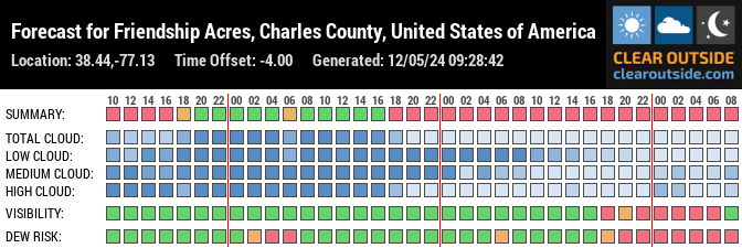
How to Use the Clear Sky Chart
Click on any block. This will send you to the Main Page of the Nanjemoy Creek Observatory Clear Sky Chart. The site explains how to read the various features of the chart. For example, if you click on the block again, it will send you to a full forecast map, with the location of the Nanjemoy Creek Observatory highlighted.